| |
|||
| 22+ Industrial Acres Fronting Southern Pacific Rail Road
|
|||
 |
|||
 |
|||
 |
|||
| Location- |
Sierra Hwy, n/o Backus Rd | |
Area- |
Rosamond / Mojave area | |
Acres- |
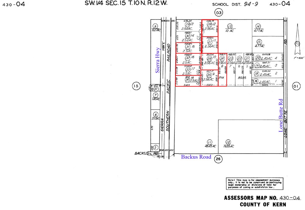
22.74 acres (9 parcels) |
|
APN- |
430- 040- 24, 25, 26, 27, 28, 31, 32, 33, & 34 |
|
Zoning- |
M-2, medium industrial (by Kern County) | |
Topography- |
level and flat | |
Dimensions- |
9 parcels, 330’ x 330’ and 220’ x 495’ approx. | |
Utilities- |
elec on Backus Rd, 1/4 mile to the south. | |
Price- |
$220,000 ($9,675 p/acre / $.22 cents psf) | |
Existing Notes- |
free & clear | |
Terms- |
all cash | |
Remarks- |
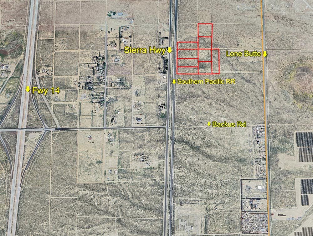
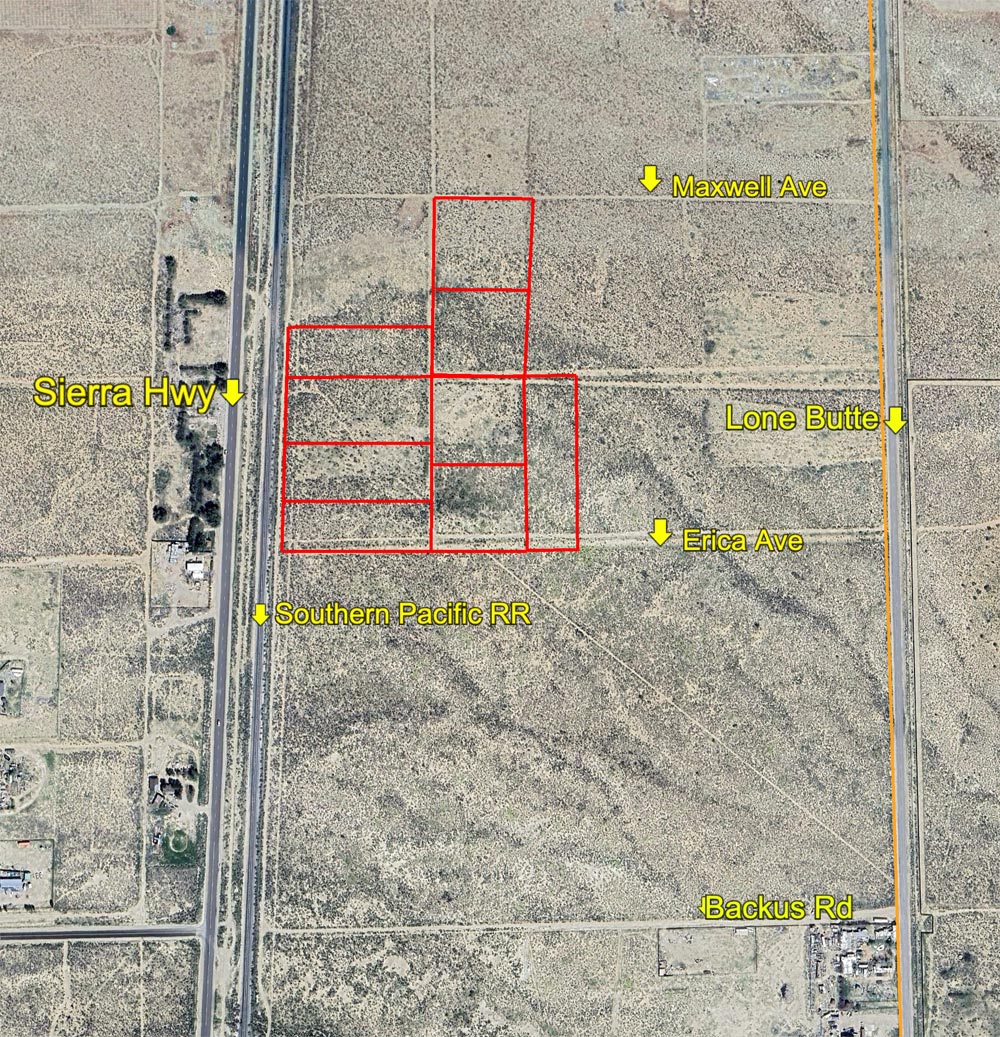
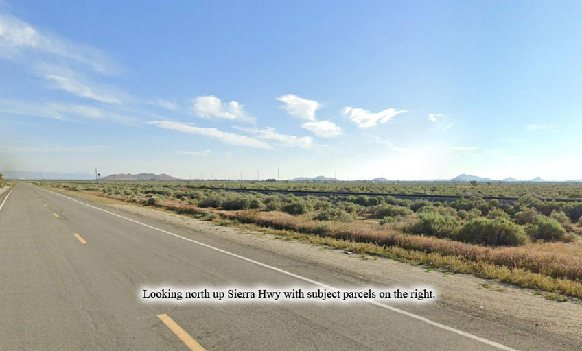
Located between Rosamond and Mojave, 9 contiguous parcels zoned medium industrial along Sierra Hwy and the Southern Pacific Rail Road, 1/2 mile north of Backus Rd. Four of the parcels actually front the railroad tracks. No utilities to the parcels at this time, but the nearest electric power line is only 1/2 mile to the south on Backus Rd. From Lone Butte Rd, two unimproved roads lead west to the group. Only two miles south of Mojave’s mining district, and 6 miles south of Mojave Air & Space Port. Huge solar farm located to the east across Lone Butte Rd. The parcels are under the jurisdiction of Kern County. The community of Rosamond is just 6 miles to the south down the Freeway 14, with Lancaster only another 10 miles. Parcels have very good visibility from Sierra Hwy. All the parcels are flat. Seller prefers all cash, but will strongly consider carrying a note with 50% down payment. The purpose of medium industrial is for general manufacturing, processing, and assembly. Click to view a catalog of allowed businesses, too numerous to list here. Highest
& Best use: develop for farm
or ranch; land banking investment |
|
Safety and Cautions- |
Anyone inspecting, or walking on the property, off the road, should be aware that rattlesnakes and other desert wild life could be in the area. Be careful and use common sense! | |
Directions to Property- |
From Palmdale or Lancaster, proceed north on the Fwy 14. Exit at Backus Rd. Go right (E) on paved Backus Rd for 1/2 mile + Sierra Hwy. At Sierra Hwy, turn left (N) and go 1/4 mile. Stop. You are now near the SW corner of the group. From this point the group of parcels is located to the NE, across the RR tracks. Four parcels front the railroad.
|
|
|
