| |
|||
|
East Palmdale Industrial Use Parcel |
|||
|
|
 |
||
 |
|||
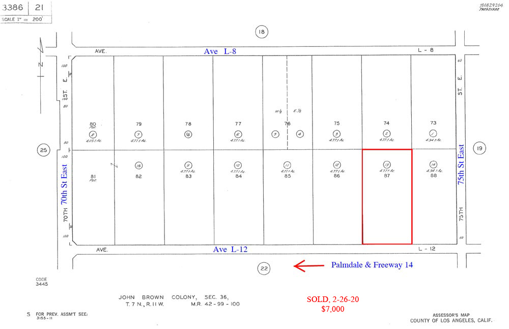
| Location- |
74th East, on L-12 | |
Area- |
east Palmdale, 4.4 miles east of Palmdale | |
Acres- |
4.77 net acres |
|
APN- |
3386-21-13 |
|
Zoning- |
M-4, Planned Industrial, City of Palmdale | |
Topography- |
flat & level | |
Dimensions- |
330' on L-12 x 629' deep | |
Utilities- |
no utilities at this time | |
Price- |
$9,500 ($1,991 p/ac) | |
Existing Notes- |
free & clear | |
Terms- |
all cash | |
Remarks- |
Subject
property is a path of growth industrial
property, zoned by the City of Palmdale. The land use
of M-4, Planned Industrial,
allows for light industrial business park type uses. Four miles to the
west of subject property is Plant 42, home of three great aerospace
defense giants, Boeing, Northrop Grumman,
and Lockheed Martin.
Plant 42 is often referred to as the “aerospace
capital of the world.” Ave L-12, although
not yet created, is a legal street (see assessors map) and does provide
legal access for the subject parcel. The US Air Force provides onsite
security at Plant 42. Parcel is flat and level. Affordable investment
starter parcel. |
|
Safety and Cautions- |
Anyone inspecting, or walking on the property, off the road, should be aware that rattlesnakes and other desert wild life could be in the area. Be careful and use common sense! | |
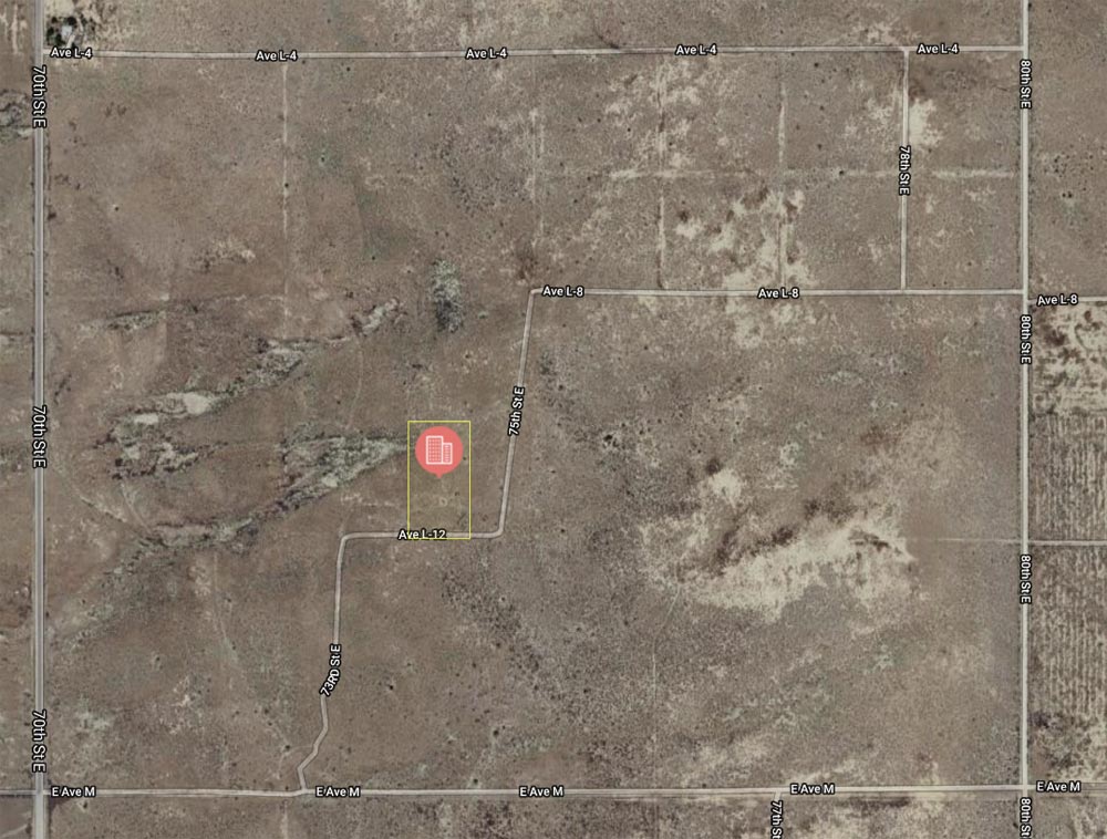
Directions to Property- |
Exit
Fwy 14 at Ave K. Go east on Ave K for approx 8.5 miles to 70th St East.
At 70th East, turn right (S) and proceed 2 miles to Ave M (dirt). Turn
left (E) on Ave M, a dirt road, and go 3/10 of a mile to dirt road on
your left. Turn left (N) on dirt road, follow to property. From Ave
M, distance to property is 3/10 of a mile. See below photo. |
|