|
||||
|
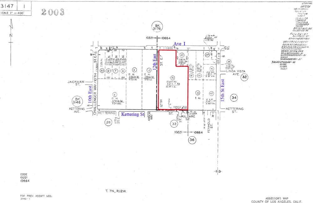
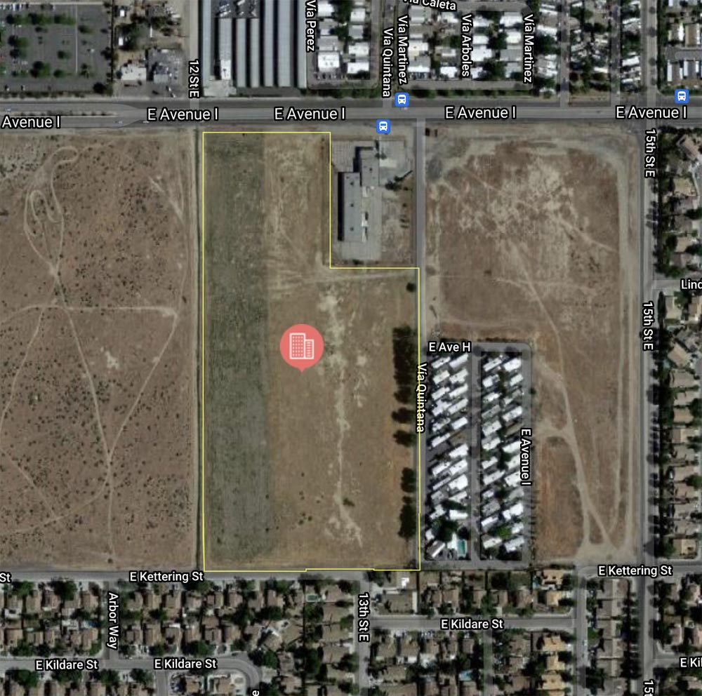
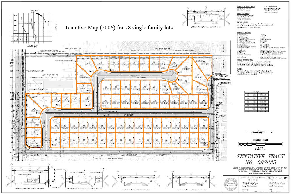
78 Lot Tentative Map @ 12th East on Ave I |
||||
|
|
 |
|||
 |
||||
 |
||||
 |
||||
 |
||||
| Location- |
@ 12th St East, on Ave I | |
Area- |
east Lancaster | |
Acres- |
16.93 acres |
|
APN- |
3147- 001- 052 |
|
Zoning- |
R 7,000 | |
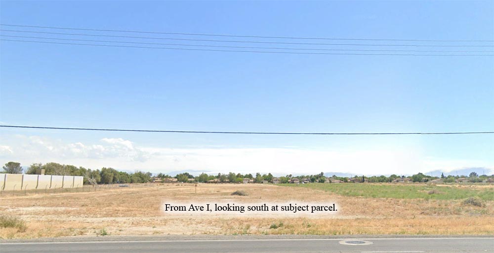
Topography- |
flat & level | |
Dimensions- |
660’ x 1,270’ deep (approx.) . | |
Utilities- |
on Ave I (north) and Kettering (south) | |
Price- |
$1,600,000 ($94,506 p/ac) | |
Existing Notes- |
free & clear | |
Terms- |
all cash | |
Remarks- |
This east Lancaster 16.93 acre parcel was mapped (TM 062635) in 2006 for 78, 7,000 sq foot, single family lots. The Map needs to be renewed through the City of Lancaster. Parcel is zoned R 7,000 by City of Lancaster. All utilities are on Ave I (north) and Kettering St (on the south). The Lancaster and Palmdale areas are in the midst of a record housing shortage. For a population approaching 500,000, there is an avg total of 500 active residential listings in the local multiple listing service. For home buyers that commute, the AV Fwy 14 is just 3 miles to the west. Highest
& Best use: renew tentative map / build single family homes |
|
Safety and Cautions- |
Anyone inspecting, or walking on the property, off the road, should be aware that rattlesnakes and other desert wild life could be in the area. Be careful and use common sense! | |
Directions to Property- |
From
the AV Freeway 14, exit at Ave I. Using your odometer, go east on Ave
I for 3.5 + miles to 10th St East. From 10th St East, continue on 2/10
more of mile. Stop. Subject
on your right. Sign on Property. Parcel is located directly across the
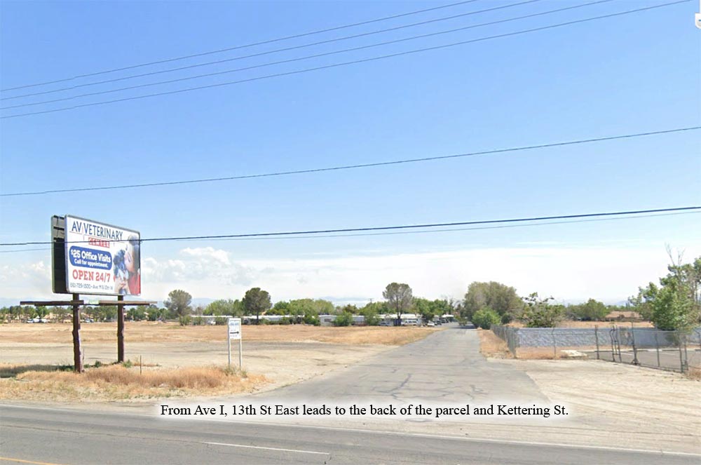
street from Stor Rite mini storage facility. Use 13th St East (see ground
photo) to access southern portion of property at Kettering St. |
|