| |
|||
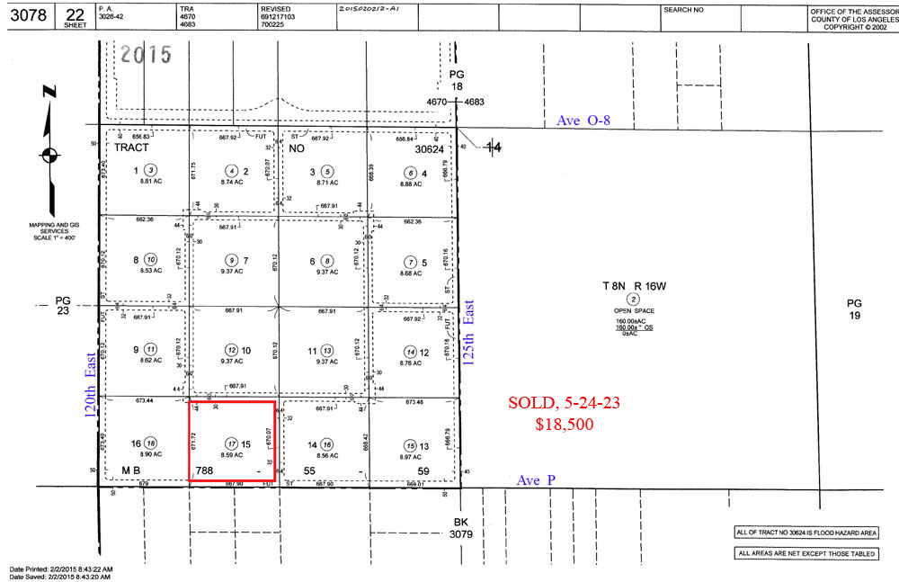
| 8.59
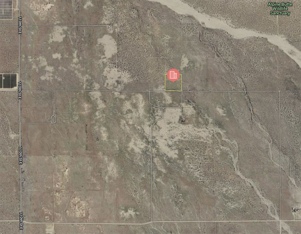
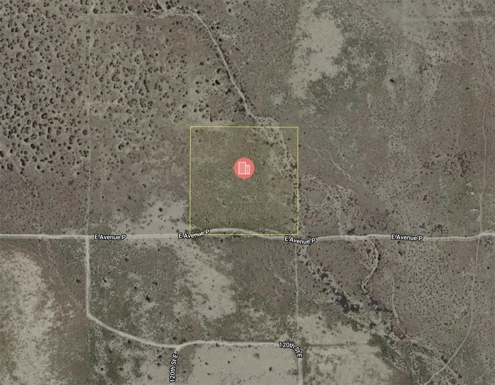
Acres, 122nd St East, on Ave P, east Palmdale |
|||
|
|
 |
||
 |
|||
 |
|||
 |
|||
| Location- |
122nd St East, on Ave P | |
Area- |
east of Palmdale | |
Acres- |
8.59 net acres |
|
APN- |
3078- 022- 017 |
|
Zoning- |
A 2 2, R L 20 | |
Topography- |
flat & level | |
Dimensions- |
589’ x 635’ | |
Utilities- |
elec power line on Ave P | |
Price- |
$21,475 | |
Existing Notes- |
free & clear | |
Terms- |
all cash | |
Remarks- |
Investor path of growth parcel due east of Palmdale.
Parcel is just outside the city limits of Palmdale (110th St East).
Zoning of A 2 2 means heavy agriculture which also allows for a residence
with farm animals / crops. R L 20 means "rural land, one home per
20 acres”. Commercial solar farm use is also allowed. Elec power
lines are on Ave P, south of the dirt road. Parcel is flat & level.
Good candidate for land banking.
Highest
& Best use: investment; land bank |
|
Safety and Cautions- |
Anyone inspecting, or walking on the property, off the road, should be aware that rattlesnakes and other desert wild life could be in the area. Be careful and use common sense! | |
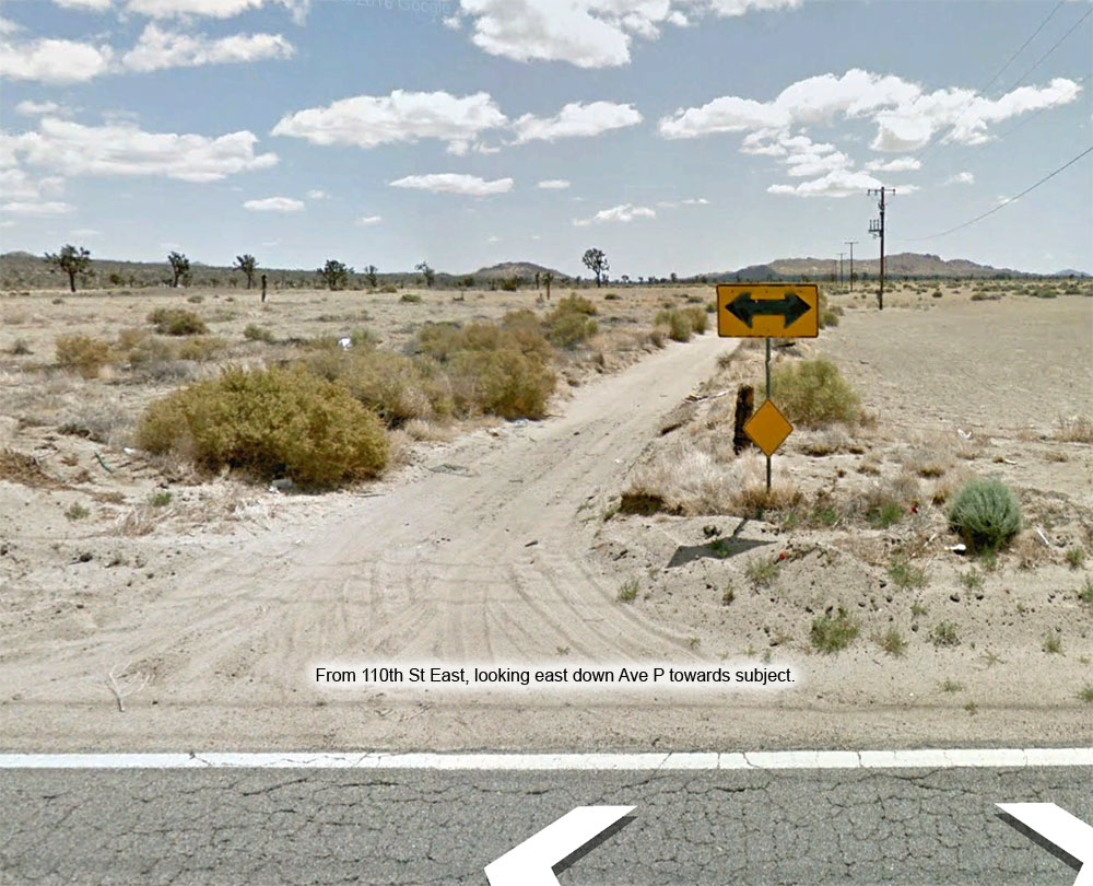
Directions to Property- |
From
the AV Freeway 14, exit at Palmdale Blvd. Go east on Palmdale Blvd through
the downtown area to the traffic rotary at 47th St East. Bear left at
the rotary to remain on Palmdale Blvd. Continue east on Palmdale Blvd
to 90th St East. At 90th East, turn left (N), go 1.5 mi to Ave P. At
Ave P, turn right (E) & go 1.2 miles (use odometer). Stop.
Subject parcel is on your left, the north side of Ave P. |
|
|