|
||||
|
21.70 Acres in Pearblossom, Contiguous to Aqueduct |
||||
|
|
 |
|||
 |
||||
 |
||||
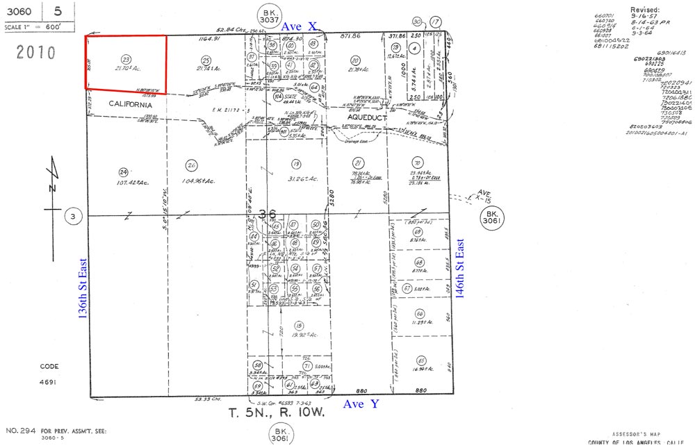
| Location- |
on 136th St East @ Ave X, NE corner | |
Area- |
Pearblossom | |
Acres- |
21.70 net acres |
|
APN- |
3060- 5- 23 |
|
Zoning- |
A 2 2, heavy agriculture, R L 10 | |
Topography- |
flat & level | |
Dimensions- |
west border, 765’ x 1,235’ (approximate) | |
Utilities- |
elec and tele at NW corner of property | |
Price- |
$54,000 ($2,488 p/acre) | |
Existing Notes- |
free & clear | |
Terms- |
all cash | |
Remarks- |
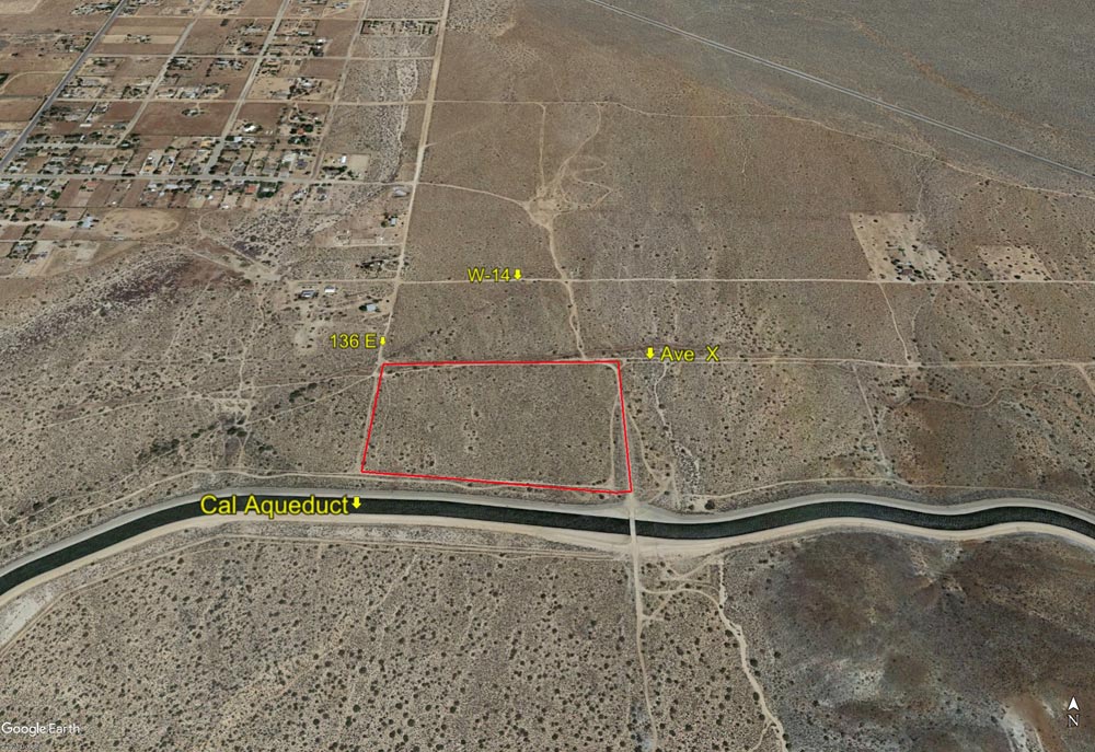
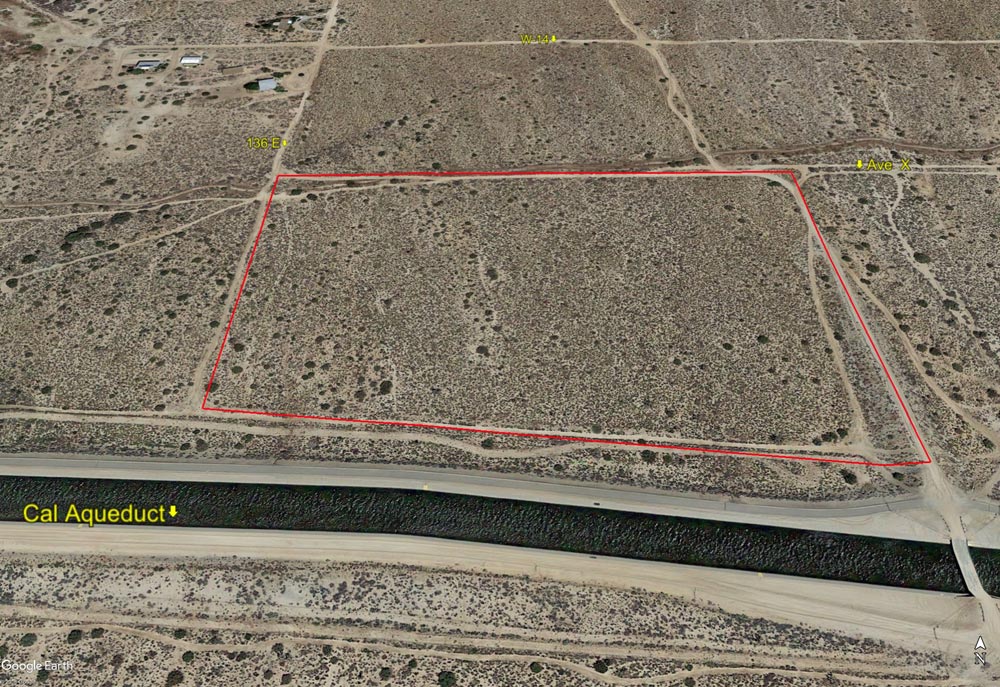
Investor path
of growth parcel for the Pearblossom area with the elec at the NW corner
of property, on 136E. Parcel is slightly irregularly shaped but is very
close to a rectangle. Municipal water is on Ave W-14 660 feet to the
north. Several homes to NW, just across 136E. Topography is a very gentle
slope with great views of the AV floor, but no loss of property due
to hills. Parcel is just 1.75 miles south of Pearblossom Hwy which leads
west into Pearblossom, Littlerock, and Palmdale and east to Victorville
and the Freeway 15. Zoning of A 2 2 allows for residential use with
farm animals and horses as well as commercial solar use. Parcel backs
up to California Aqueduct; a short walk to go fishing. Most probable
source of water would be a well. Due to its size, views, and zoning,
parcel has a lot of flexibility for an investor or someone seeking a
home site. |
|
Safety and Cautions- |
Anyone inspecting, or walking on the property, off the road, should be aware that rattlesnakes and other desert wild life could be in the area. Be careful and use common sense! | |
Directions to Property- |
From
the Freeway 14, exit at Ave S and go east on Ave S to 47th St East.
At 47th St East turn right (S) and stay on Pearblossom Hwy (138) which
will bend to the left (southeast). Stay on Pearblossom Hwy passing through
the communities of Littlerock and Pearblossom. As you leave Pearblossom,
turn right (south) at Longview Rd (at Chevron station). Proceed 1/2
mile on Longview Rd, then turn left (east) on Ave W. Continue east on
Ave W for 1/2 mile to 136th St East, a dirt road. Turn right (south)
on 136th St East. The street sign for 136E is on the north side of Ave
W. Proceed south on 136E for 1 mile to Ave X (dirt road). Stop.
You are now at the NW corner of subject parcel. |
|