| |
|||
| 40
Acres n/o California City Airport |
|||
|
|
 |
||
 |
|||
 |
|||
 |
|||
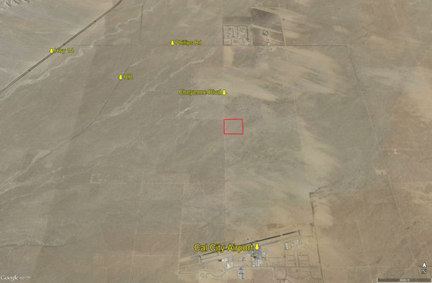
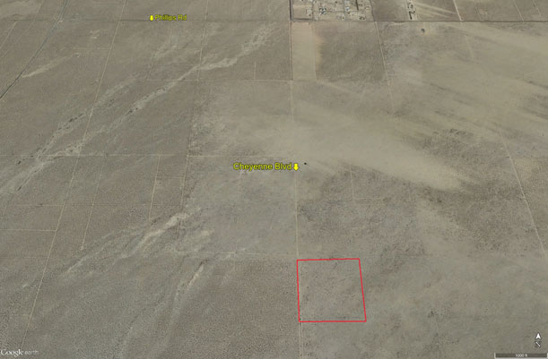
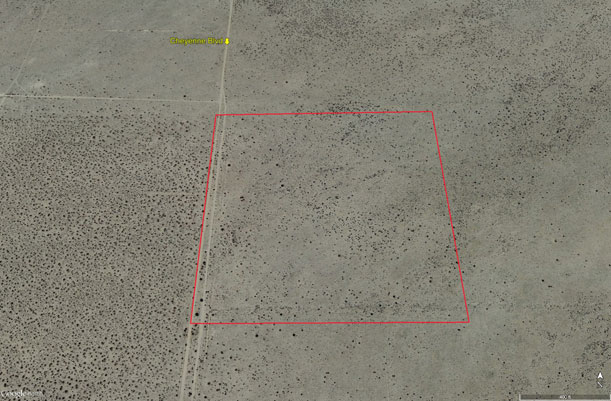
| Location- |
north of California City’s Airport | |
Area- |
n/o California City | |
Acres- |
40 net acres | |
APN- |
302- 342- 01 | |
Zoning- |
Miscellaneous Vacant Land; residential use OK | |
Topography- |
flat & level | |
Dimensions- |
1320’ x 1320’ | |
Utilities- |
none to parcel | |
Pricing- |
$22,000 ($550 per acre) | |
Existing Notes- |
free and clear | |
Terms- |
all cash | |
Remarks- |
Located 1.5
miles north of the California City Municipal Airport and 1.5 + miles
south of Phillips Rd on Cheyenne Blvd. Flat and level, no utilities
to property at this time. Parcel is currently zoned by Kern County.
Square 40 acres that is investor priced. |
|
Safety and Cautions- |
Anyone inspecting, or walking on the property, off the road, should be aware that rattlesnakes and other desert wild life could be in the area. Be careful and use common sense! | |
Directions to Property- |
North on Hwy 14 to Mojave. Go north through downtown Mojave to Hwy 14. Go NE on Hwy 14 for 11+ miles to Phillips Road. Turn right (east) on paved Phillips Road and go 2.5 miles to Cheyenne Blvd, a dirt road. At Cheyenne Blvd turn right (south) and go 1.5 miles. At the 1.5 mile mark on your odometer. Stop, go 100 more feet and you are near the NW corner of subject property. |
|