| |
|||
| Industrial
5 Acres near Cal City Airport |
|||
|
|
 |
||
 |
|||
 |
|||
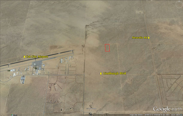
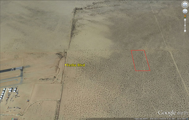
| Location- |
1/2 mile n/e of California City Airport | |
Area- |
California City | |
Acres- |
5 acres | |
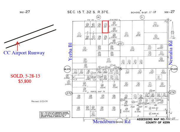
APN- |
302- 271- 27 | |
Zoning- |
Industrial, California City | |
Topography- |
flat | |
Dimensions- |
330’ x 660’ | |
Utilities- |
none to property | |
Price- |
$7,500 ($1,500 p/ac) | |
Existing Notes- |
free and clear | |
Terms- |
all cash | |
Remarks- |
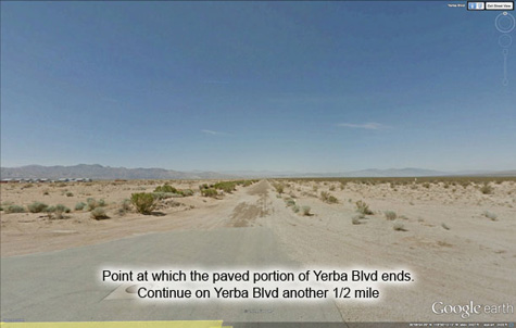
Located 1/2 mile
north east of the California City Municipal Airport. Zoned industrial
by the California City. Located on a dirt road, no utilities. Easy parcel
to view, see directions below. The CC Municipal Airport covers 245 acres,
has one asphalt runway that is 6,027 feet long, and is operated by California
City. Local owners use it to park and refuel their private planes. The
airport is open to the public and has a restaurant as well. California
City was incorporated in 1965 and has its own city services, including
police force, fire department, K-12 schools, and parks and recreation.
The schools are part of the Mojave Unified School District. California
City is a master planned commmunity with over 52,000 lots, and in terms
of area, is California’s 3rd largest city. CC totals 203 square
miles and is 2,400 feet above sea level. California City’s population
at the 2010 census was 14,120, up +68% vs the 2000 census. Buyer to verify the location and access costs of all utilities. |
|
Safety and Cautions- |
Anyone inspecting, or walking on the property, off the road, should be aware that rattlesnakes and other desert wild life could be in the area. Be careful and use common sense! | |
Directions to Property- |
|
|