|
||||
|
10 Divisible Residential Acres near Santa Clarita |
||||
|
|
 |
|||
 |
||||
 |
||||
 |
||||
 |
||||
 |
||||
 |
||||
 |
||||
 |
||||
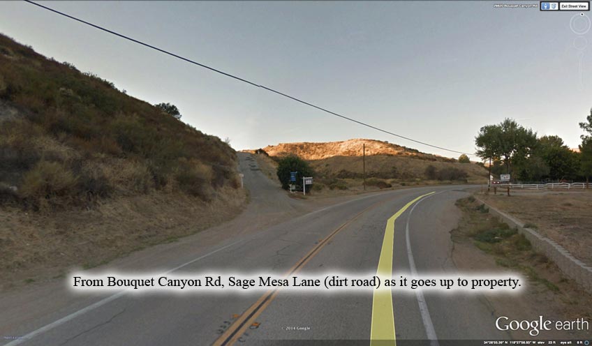
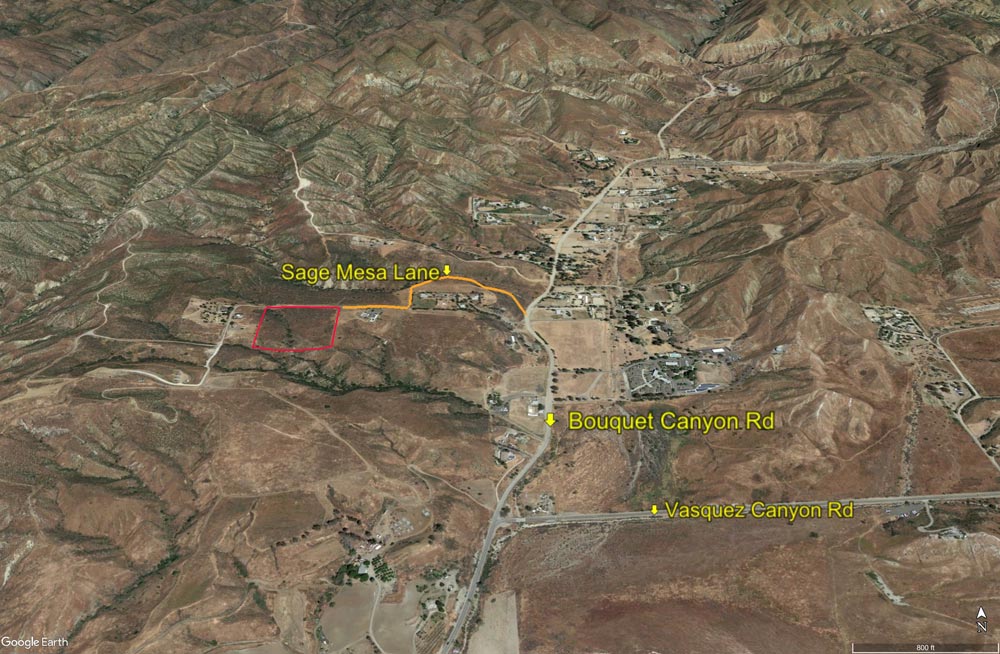
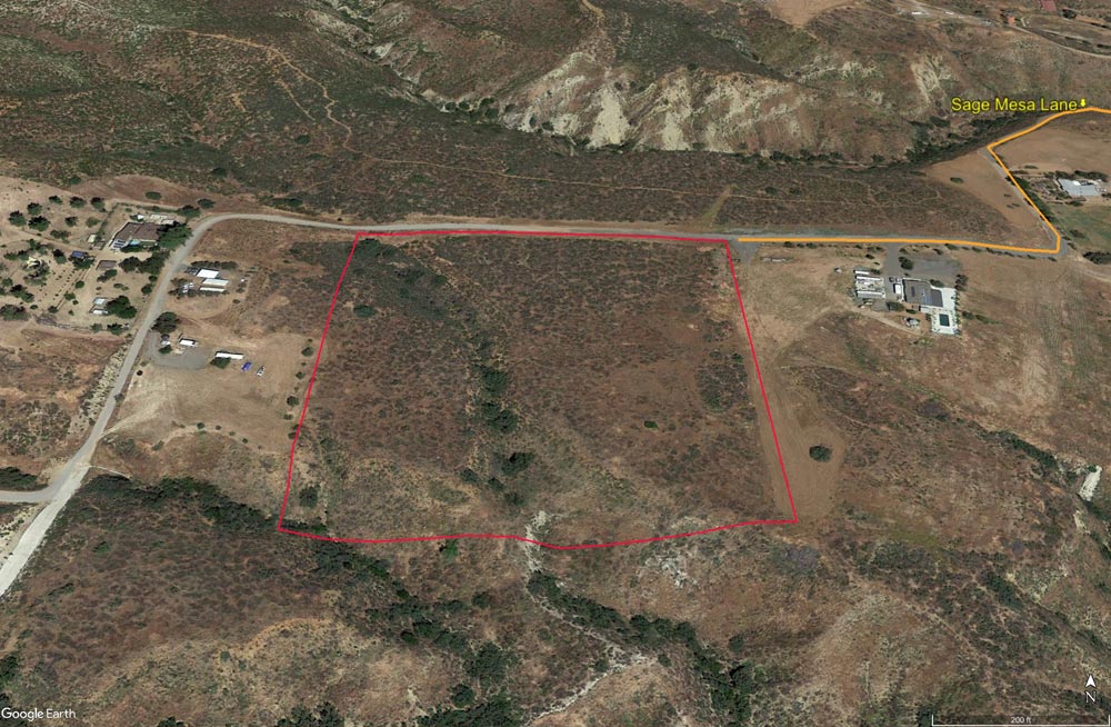
| Location- |
w/o Bouquet Canyon Rd, . | |
Area- |
just north of Santa Clarita | |
Acres- |
10 acres |
|
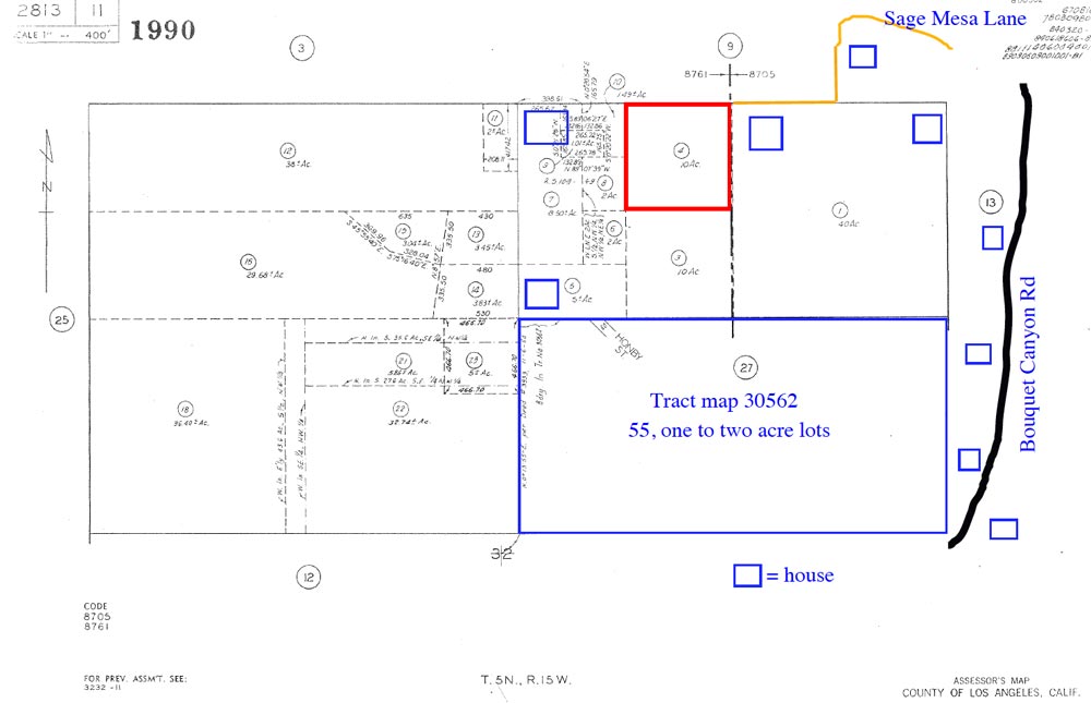
APN- |
2813- 11- 4 |
|
Zoning- |
A 1 2 (R L 2) light agriculture, 1 home per 2 acres | |
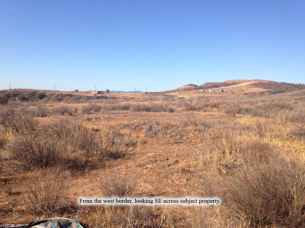
Topography- |
flat with some varied topography | |
Dimensions- |
660’ x 660’ | |
Utilities- |
elec & tele nearby, many homes in area | |
Price- |
$270,000 / $27,000 per acre | |
Existing Notes- |
free and clear | |
Terms- |
all cash or 50% down, OWC over 3 years, interest only | |
Remarks- |
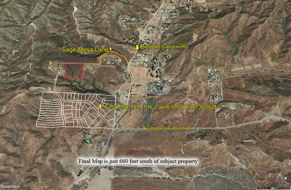
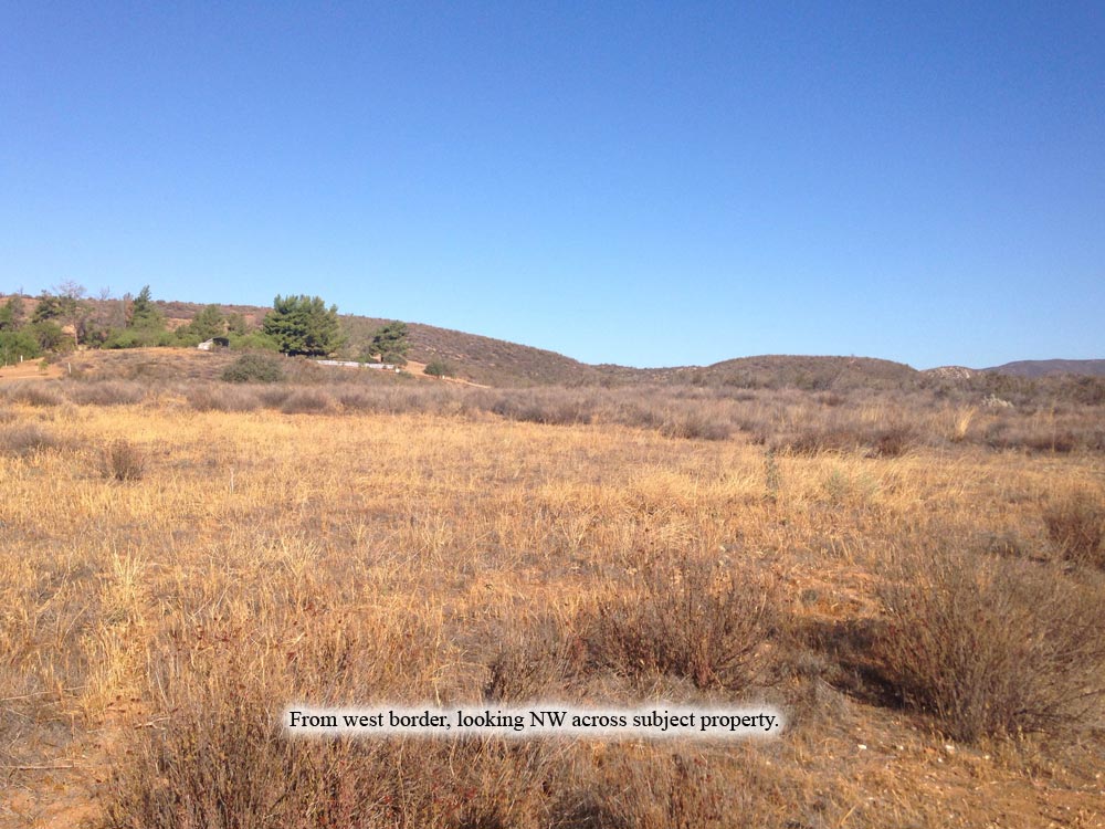
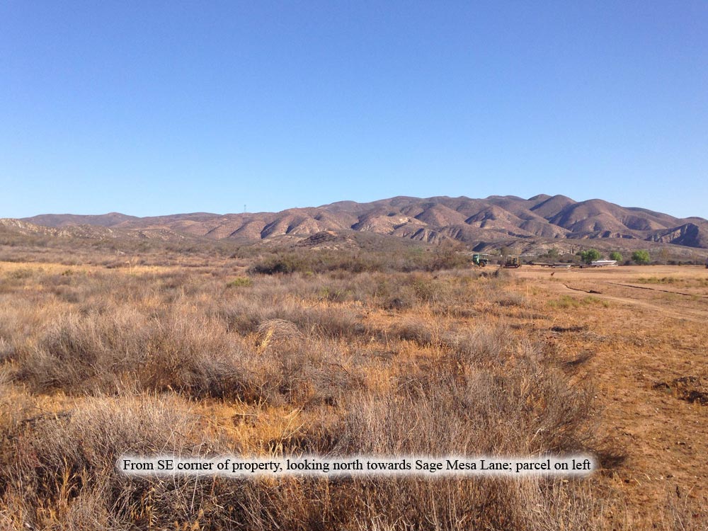
Rare find, a
ten acre residential parcel in foothills near Santa Clarita, that CAN
be subdivided. Most of parcel is a mesa or plateau. Many homes surround
parcel, bringing the elec & tele near. Just 660 feet to south is
a recorded Final tract map (30562) for 55, one to two acre home sites
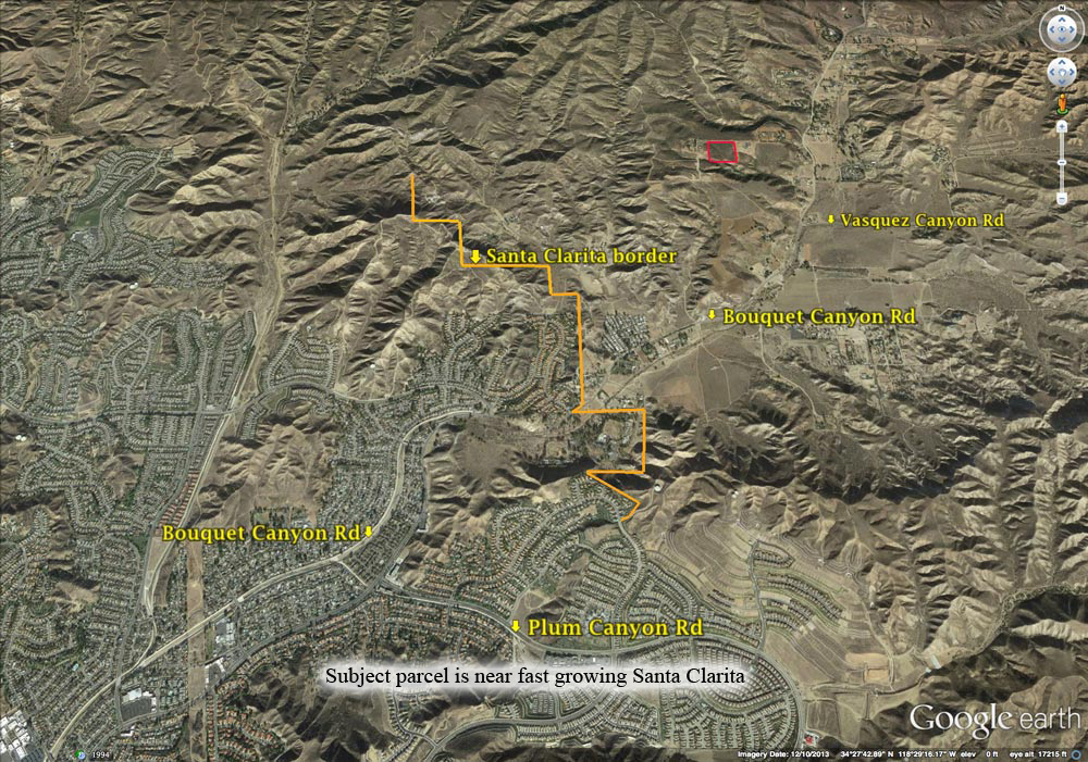
(see photo 4 above). Photo 1 above shows that the Santa Clarita City
border is just 1.4 miles to south, 2.1 miles if you drive to it along
Bouquet Canyon Rd. Many large and high end homes in area. Current zoning
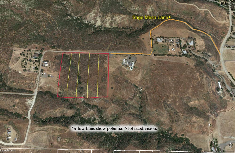
allows parcel to be divided into five, 2 acre home sites. |
|
Safety and Cautions- |
Anyone inspecting, or walking on the property, off the road, should be aware that rattlesnakes and other desert wild life could be in the area. Be careful and use common sense! | |
Directions to Property- |
From
Palmdale: Go south on the Fwy 14 to the Red Rover Mine
Rd offramp. Turn left at top of the offramp, then bear right to Sierra
Hwy. Proceed south on Sierra Hwy for 14 miles to Vasquez Canyon Rd.
Turn right (heading west) on Vasquez Canyon Rd and go 3.6 miles to Bouquet
Canyon Rd.
|
|