| |
|||
|
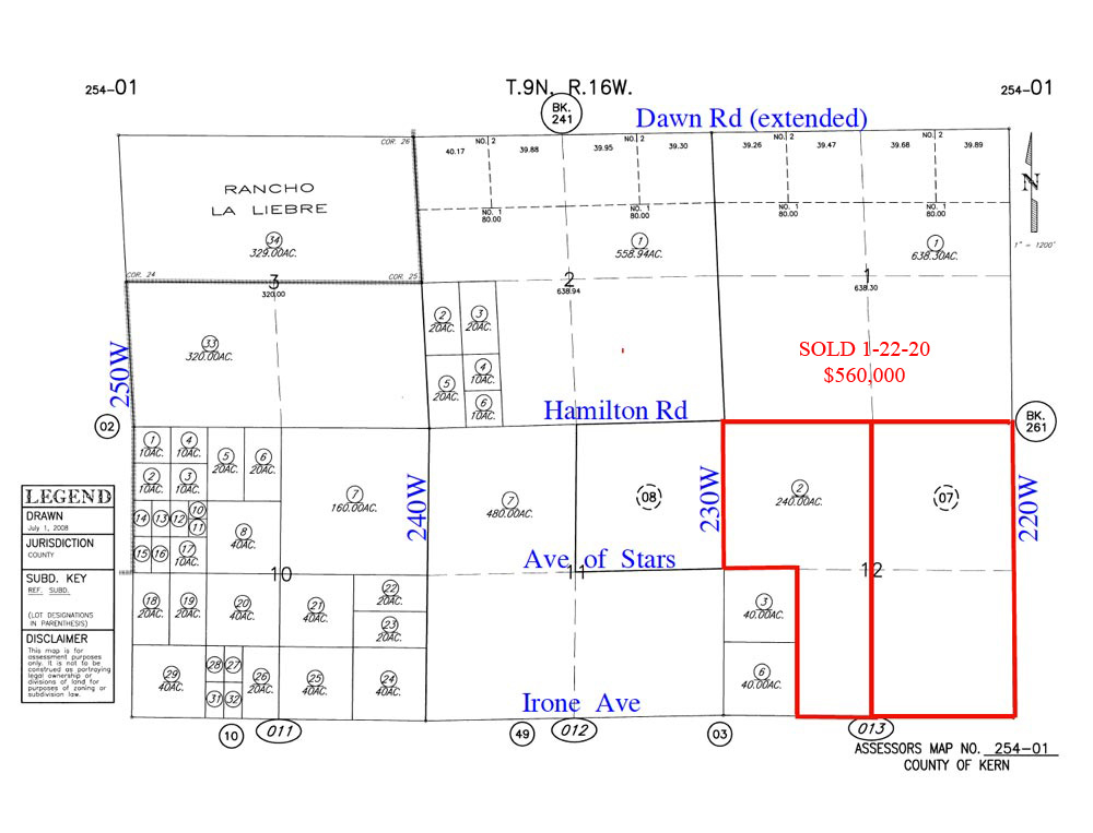
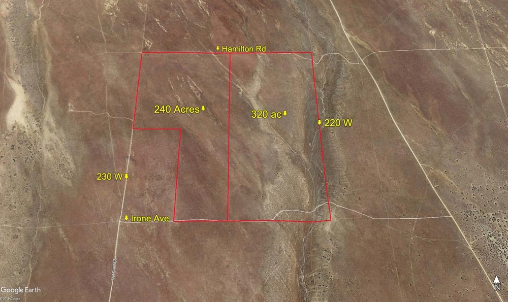
560 Acres, 230th St West, n/o Rosamond Blvd |
|||
|
|
 |
||
 |
|||
 |
|||
| Location- |
at 230th St West, 1 mile n/o Rosamond Blvd. (extended) | |
Area- |
17 miles west of Rosamond | |
Acres- |
560 acres |
|
APN- |
254- 070-07 & 254-013-02 (contiguous) |
|
Zoning- |
A (agriculture) | |
Topography- |
flat & level | |
Dimensions- |
5,280 ft x 5,280 ft (less 80 acres) | |
Utilities- |
none to parcel | |
Price- |
$560,000 ($1,000 per acre) | |
Existing Notes- |
free & clear | |
Terms- |
all cash | |
Remarks- |
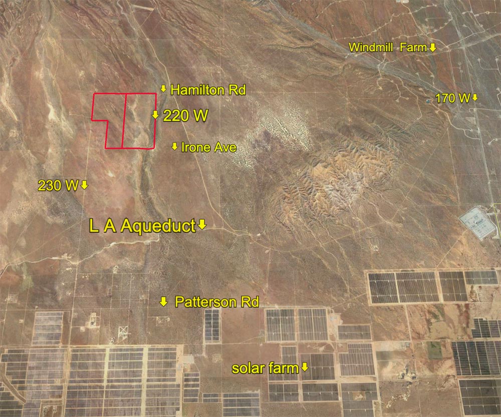
Located
NW of Lancaster, and west of Rosamond. Cross streets of subject parcel
are 230th St West, with Hamilton Rd (extended) the northern border and
Irone Ave (extended) the southern border. Parcels are one mile n/o Rosamond
Blvd. Parcels are just two miles north/northwest of a major solar farm
and 3+ miles west of a major wind farm. Parcels are a pure land banking
play, suitable for the long term investor. Parcels are flat with gentle
grade, north to south. Together the parcels are one section, less 80
acres at the SW corner of section 12 (see above map). |
|
Safety and Cautions- |
Anyone inspecting, or walking on the property, off the road, should be aware that rattlesnakes and other desert wild life could be in the area. Be careful and use common sense! | |
Directions to Property- |
These
directions will take you to the area of the property, close but NOT
exactly to it. Property corners are not marked. Use your odometer, you
cannot rely on every street having a sign…………………From
the AV Freeway 14, exit at Ave D (Hwy 138). Go west on paved Ave D for
approximately 21 miles to 230th St West (paved with street sign). Turn
right (N) on 230W and go 7 miles to Irone Ave (no sign). 230th St West
is paved north to Ave B. From there, north to Irone, 230W is a dirt
road. Once you have gone 7 miles on 230W, subject parcels are NW from
this point. See aerial photos.. |
|