|
||||
|
20 Acres SE of Mojave- Investor Priced !
|
||||
 |
||||
 |
||||
 |
||||
 |
||||
| Location- |
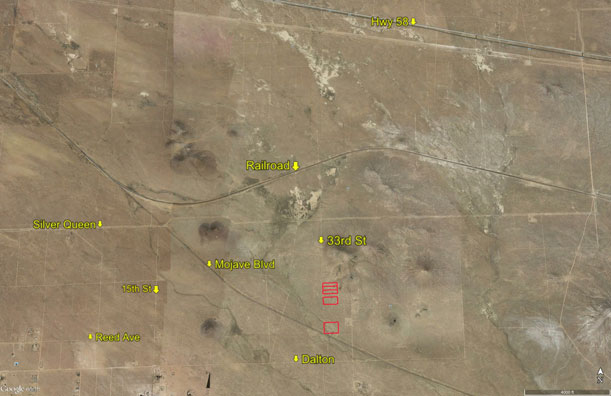
approximately 6.5 miles SE of central Mojave | |
Area- |
Mojave | |
Acres- |
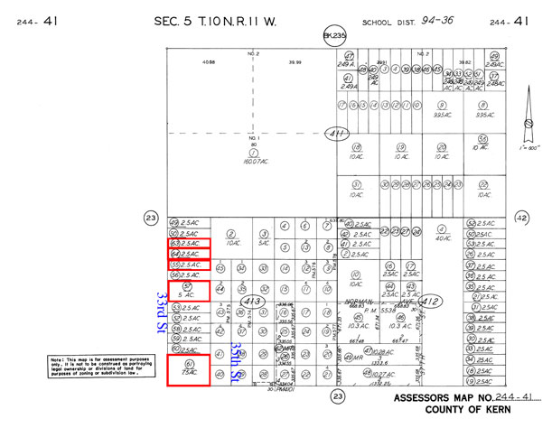
20 acres in 5 parcels | |
APN- |
244- 413- 55, 57, 61, 63, & 64 | |
Zoning- |
Miscellaneous Vacant Land (by Kern County) | |
Topography- |
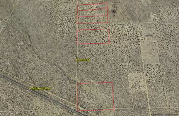
level and flat | |
Dimensions- |
2.5 acre parcels are 165' x 660' 5 acre parcel is 330' x 660' 7.5 acre parcel is 495' x 660' |
|
Utilities- |
power line on property | |
Price- |
$16,000 ($800 p/ac) | |
Existing Notes- |
free and clear | |
Terms- |
all cash | |
Remarks- |
Located SE
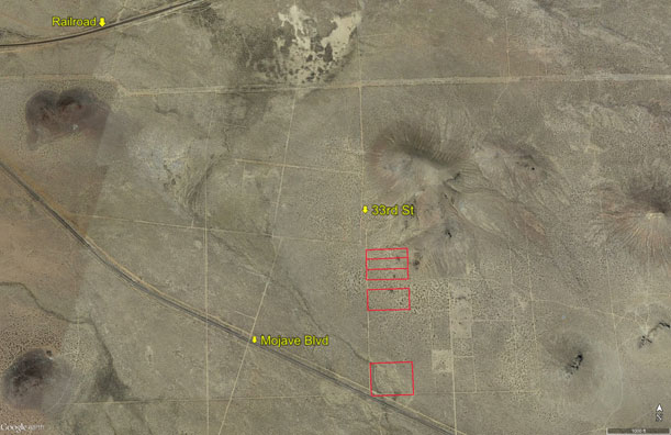
of Mojave and its Space and Airport. Parcel is located
4 miles east of Sierra Hwy and 6/10 of a mile south of Silver Queen
Rd (extended). Parcels 61, 57, and 55 are flat and level. Parcel 63
and 64 back up to a butte and have some incline at the east end. Power
line on parcel 61 just NE of Mojave Blvd. Subject parcels front on a
section line (section 5). |
|
Safety and Cautions- |
Anyone inspecting, or walking on the property, off the road, should be aware that rattlesnakes and other desert wild life could be in the area. Be careful and use common sense! | |
Directions to Property- |
From Palmdale or Lancaster, proceed north on the Fwy 14. Proceed past Rosamond and continue north towards Mojave. As you approach Mojave, turn right (east) on Purdy Ave. Go east on Purdy for 1 mile where it bends south and becomes United St. Go south on United St for 2 miles. Dirt road is Silver Queen but has no street sign. Go east on Silver Queen Rd for 2.5 miles. Then continue to follow the dirt road as it bends to the SE that has the utility poles. Follow this road for 2 miles. Stop. You are at the east border of parcel 61. Dirt road that goes due north is 33rd St. If you look due north, you should see a group of buttes about 1/2 mile away.. | |